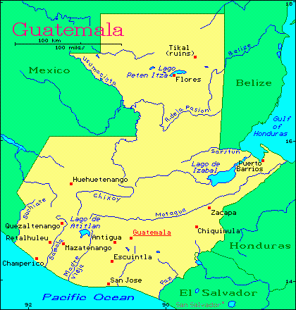
Travel to Guatemala in 1993
Recently the volcano Santa
Maria in Guatemala was designated a Decade Volcano by the United Nations. Because of the dangerous nature of its eruptions this century Santa Maria has been selected as one of the volcanoes that needs intensive study to help predict and mitigate volcanic hazards. As part of this program a conference was held in Quetzaltenango (locally known as Xela) to introduce an international group of geologists and volcanologists to the volcano and to the surrounding geology. The conference's goal was to produce a plan of action outlining specific areas of study and monitoring. The conference also included field excursions to the volcano, areas of recent volcanic deposits erupted from Santa Maria, volcanic sites in the area surrounding Santa Maria, and other volcanoes in Guatemala, including Lake Atitlan, and Pacaya.
Below are a few of the photos I took while attending the conference. Three of the photos show small eruptions that took place during the conference. The conference lasted about a week and there were numerous eruptions of this type and one good sized earthquake. It helped to highlight just how volcanically active this area is.
Click on the link to view the image.
• A street in the capital GuatemalaCity
• Government building in Parque Central, Guatemala City
• Geologists on a field trip during the Santa Maria Decade Volcano Conference
• Ash cloud rising above the clouds during a minor eruption of Santiaguito
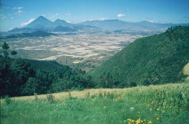
• Dome volcano located on the flank of Cerro Quemado - Quetzaltenango (Xela) is located at the far left
• Santiaguito and Santa Maria - both are active volcanoes
• A small eruption on Santiaguito
• Lahar deposits from Santa Maria along the Rio Nima II
• Large landslide scarp and deposit
• Santa Maria Volcano
• Guatemalan woman in traditional dress
• Lake Atitlan - two volcanoes are visible on the far side of the lake
• Agua Volcano
• Small eruption on McKenney Cone, Pacaya
